Discovering Hawaii Through the Fairmont Kea Lani’s Vintage Map Collection
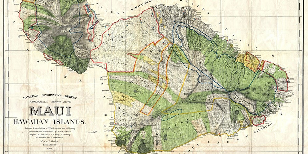
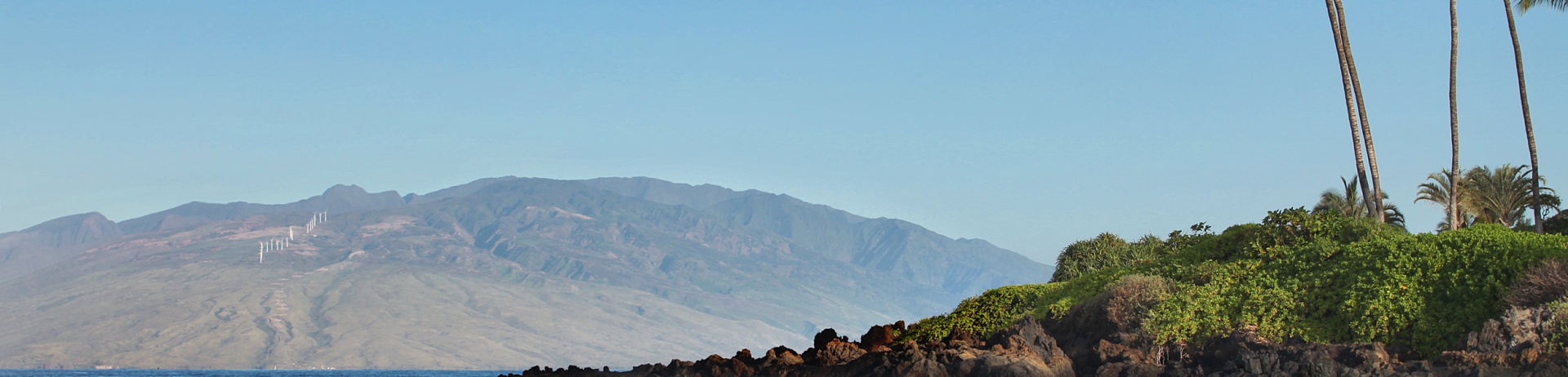
The Maui map above shows some of the island’s most famous landmarks, including Haleakalā Crater, ‘Iao Valley, and the town of Lahaina — but it can’t be used to to plan your next Maui adventure or find directions to the airport. Nearly 135 years old, this map predates Hawai’i’s statehood, the development of Wailea, and even the invention of human flight. It’s also one of the rarest and most historically significant maps of the island in existence, part of a collection of museum-quality vintage maps on display in the Fairmont Kea Lani.
“These are the first printed maps of Hawai’i by the Hawaiian government,” says Bryant Neal, a map historian based in Lahaina, who gives talks on Hawaiian history at the hotel several times a year. Hawai’i had been mapped by outsiders since the earliest days of European contact, but no official map of the islands had been created until the establishment of the Hawaiian government’s survey department in 1870. After years of conducting painstaking field surveys, the first maps of the islands were published, with the Maui map released in 1885.
“They didn’t have Google Maps or overhead views,” Neal reminds. “These guys were out there walking and hiking the land, going into all kinds of dangers to draw accurate maps of those areas.”
Looking closely at the map provides a glimpse into the Maui that these surveyors would have found at that time. “Good Agricultural Land Planted in Corn, Irish Potatoes, etc.,” is the note inscribed across one large swath of Maui’s Upcountry region, while the low, open foothills of the island’s central valley are carefully divided between the holdings of Kihei Plantation, Hawaiian Commercial and Sugar Company, and the sugar baron Claus Spreckels.
When the U.S. government annexed Hawai’i at the end of the 19th century, it used these maps to record changes in territory, and the Maui map was officially updated in 1903. “They were showing land ownership and land movement,” Neal says. “There’s all kinds of important information on those maps.”
Especially remarkable, Neal notes, is the fact that the maps weren’t intended as historical records, but were printed on cheap, thin paper for practical use in the day-to-day business of running the government. And while some collectors have one or two of the island maps, the hotel has all of them. “The fact that they survived for any length of time is amazing,” he says. “It’s a museum-quality collection, nothing short of that.”
These maps aren’t the only rare prints on display in the hotel. Neal was attending a Christmas Party at the Fairmont Kea Lani in 2018 when a set of drawings caught his eye. “I noticed that behind the concierge desk, there was a collection of images from Captain Cook’s voyages — and they’re all first-edition,” he recalls.
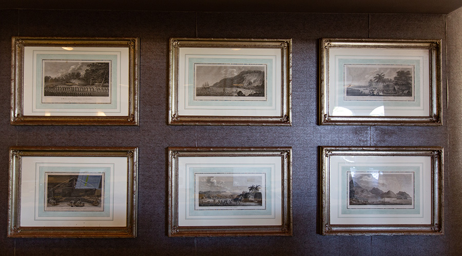
These images include a Hawaiian village scene, a depiction of a group of men gathered inside a traditional hale (house), and English sailors rowing ashore to meet a waiting group of Hawaiian villagers. The collection also includes the most famous print of the series, a view of Kealakekua Bay on Hawai’i Island, with Cook’s two ships surrounded by Hawaiians in traditional outrigger canoes, while one man paddles out on what was the first depiction of a surfboard by a Western artist.
The prints were made from drawings by John Webber, an artist who accompanied Cook on his third voyage to Hawai’i in 1778-79. “Everywhere they went, Webber did field sketches,” Neal says. “They’re the first recorded views of the Pacific (by Europeans).”
In 1784, five years after the expedition, the British Admiralty printed a run of 1,000 copies of the folio-sized sketches, which also included scenes of Aotearoa (New Zealand), Russia, Alaska, and the South Pacific. The prints were quickly bought up by British aristocrats, and remain highly sought-after by private collectors and museums.
“In most cases, stuff like that would be hidden behind closed doors,” Neal says. “The idea that these images would have made their way back to Hawaii, and in such good condition, is pretty amazing.”
The Maui island map is on display in the lobby of the Fairmont Kea Lani, to the right of the front desk, while maps of Ni’ihau, O’ahu, Kauai, Moloka’i, Lana’i, and Hawai’i Island can be viewed in a hallway past the Willow Stream Spa. The Webber prints can be viewed behind the concierge desk in the hotel lobby.